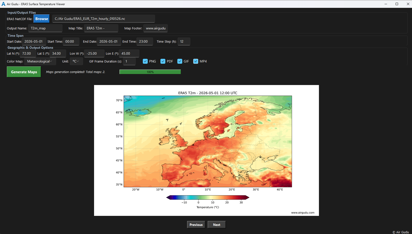
Interactive inspection of high-resolution surface temperature generation parameters.

Making the invisible visible in a changing atmosphere
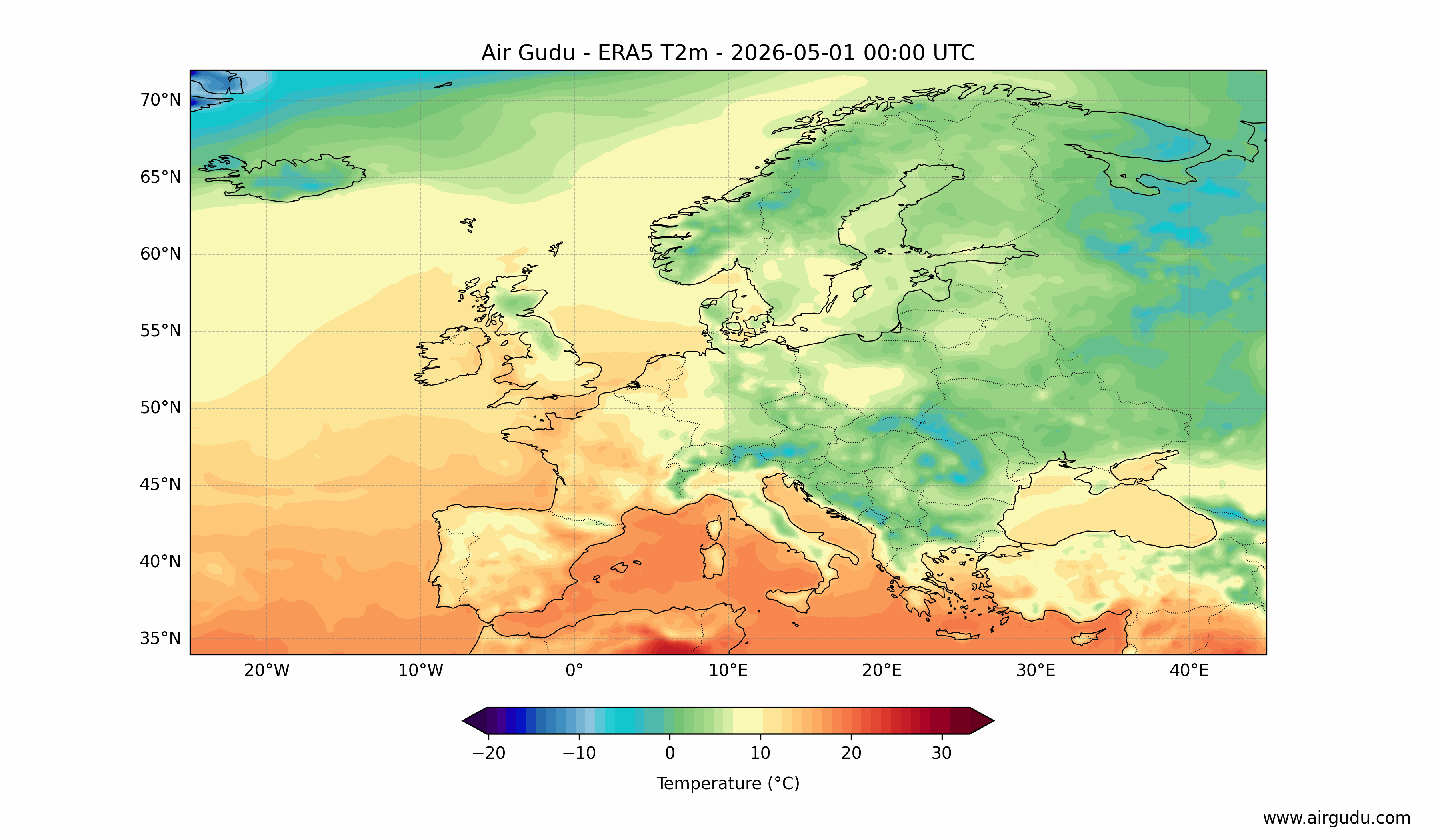
Generate high-resolution surface temperature maps with configurable layers for detailed analysis.
Interactive inspection of high-resolution surface temperature generation parameters.
Full professional functionality.
Limited basic features.
Process large ERA5 surface temperature NetCDF datasets entirely offline. Optimized engine ensures smooth, stable, and fast performance on standard desktop hardware.
Designed for scientific reliability and transparency. Full control of data handling, processing parameters, and reproducible outputs.