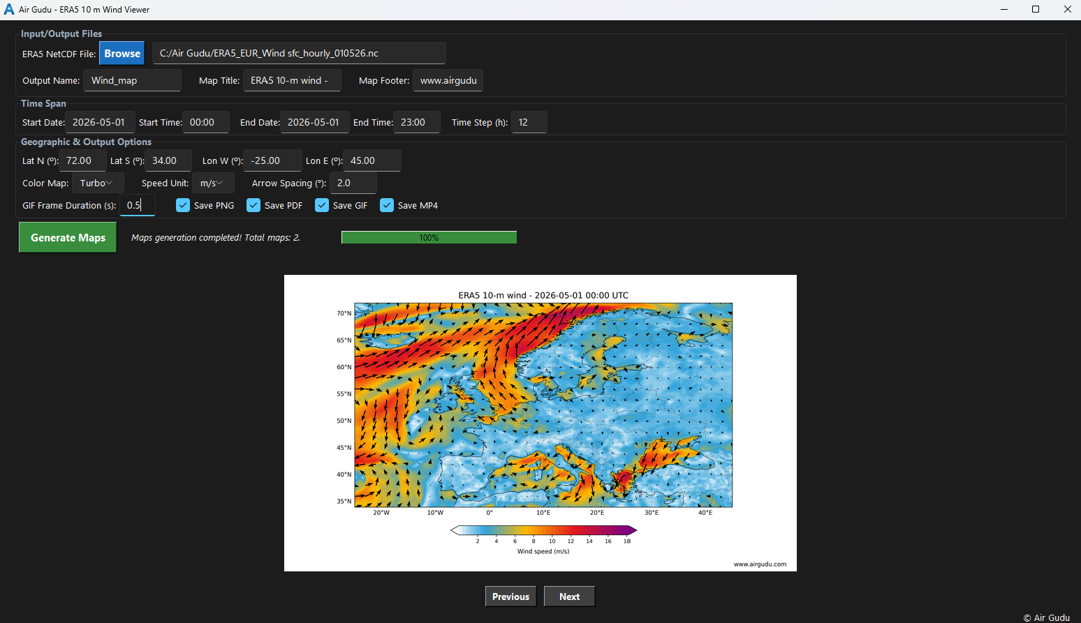
Configurable ERA5 Surface Wind Viewer for generating maps and animations.

Making the invisible visible in a changing atmosphere
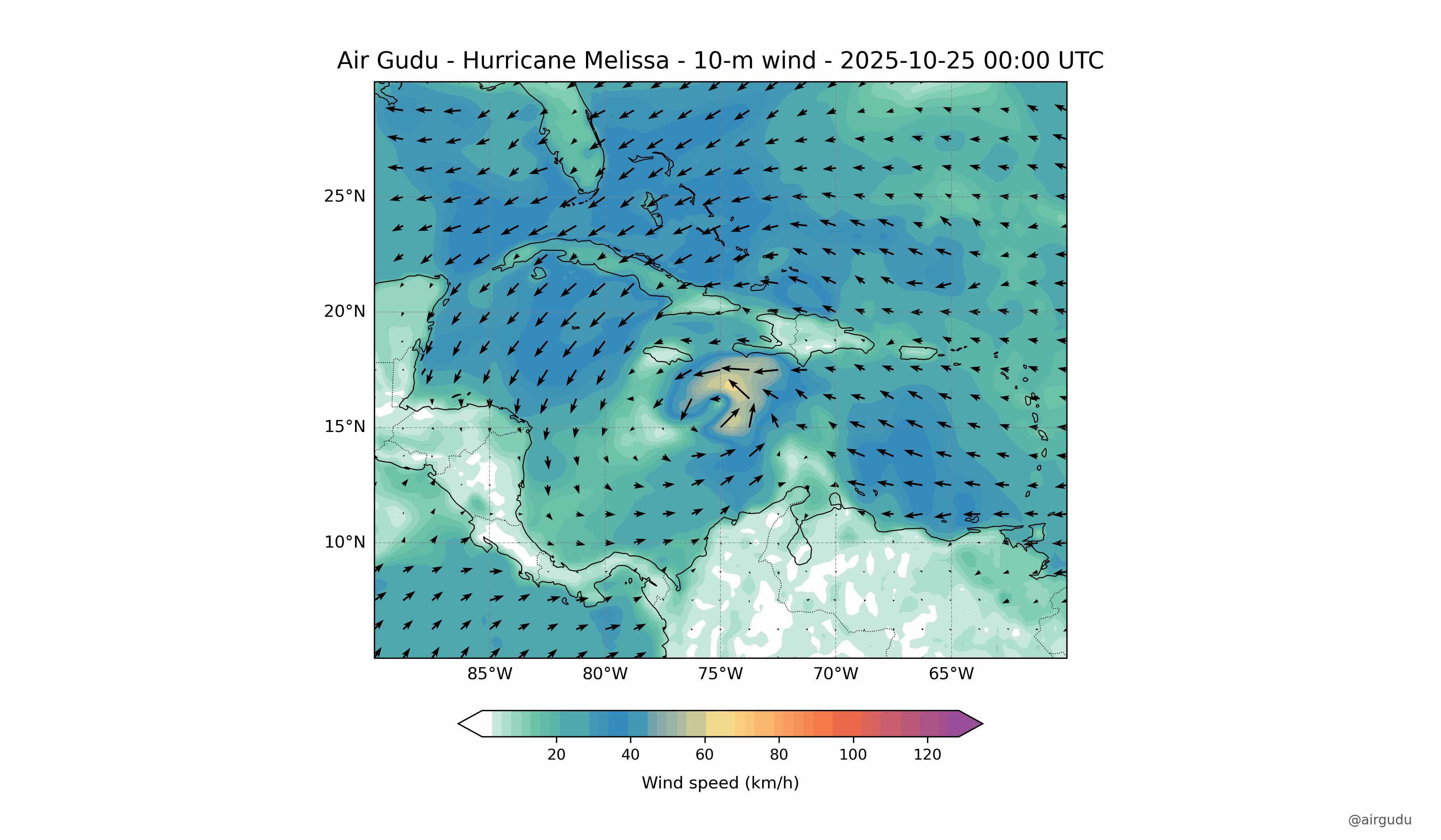
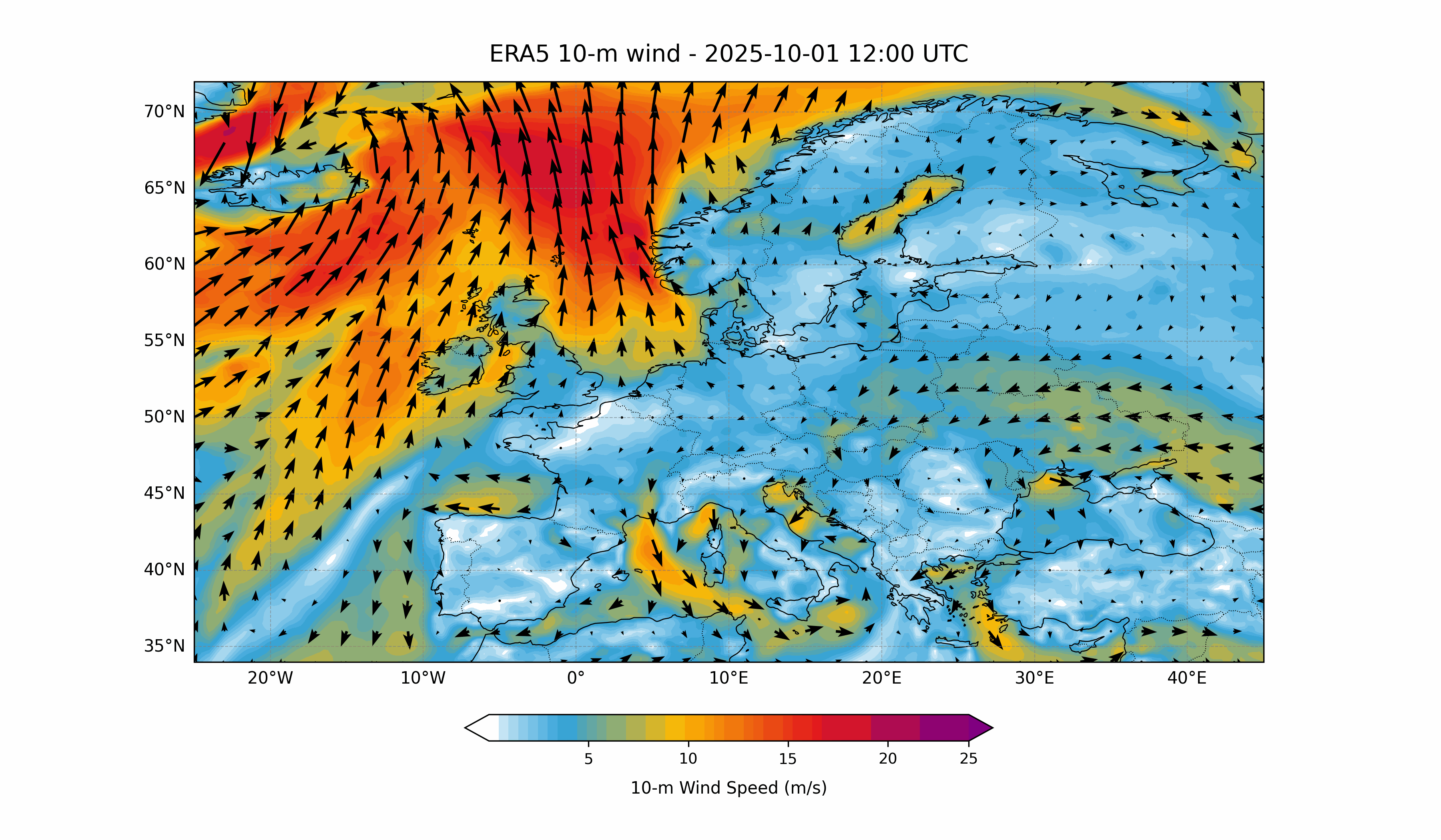
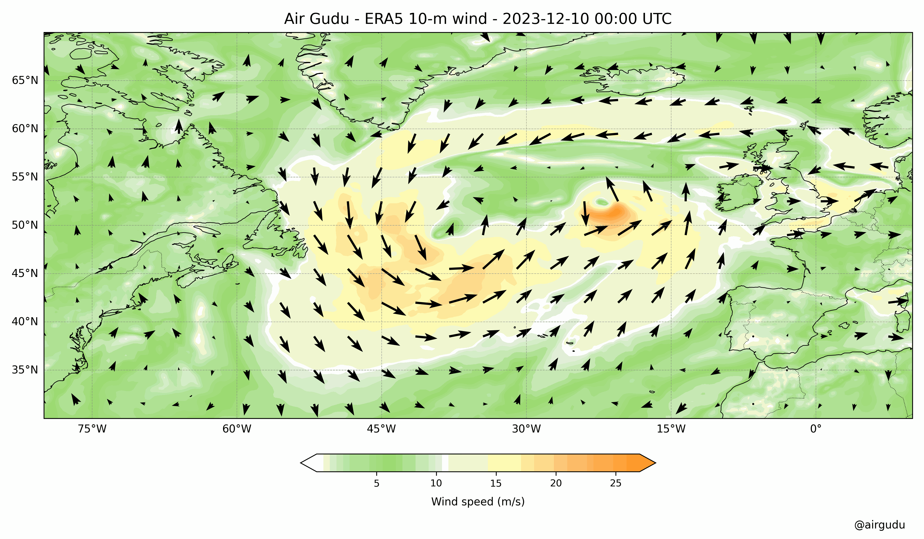
ERA5 10 m surface wind maps are widely used to analyse atmospheric circulation, evaluate wind variability, investigate extreme weather events, and distinguish synoptic- and mesoscale atmospheric processes. They play a key role in atmospheric transport and air quality studies, pollutant dispersion analysis, storm and cyclone monitoring, renewable energy and wind resource assessment, climate services, environmental consulting, and operational decision-making. They are also invaluable for scientific research, university teaching, scientific publications, and communicating atmospheric processes through clear, high-quality visualizations.
Load your ERA5 NetCDF file and generate surface wind maps and animations from the 10 m wind components (u10 and v10), using colour-filled wind speed and vector arrows—in just a few minutes.
Configurable ERA5 Surface Wind Viewer for generating maps and animations.
Process large ERA5 10 m wind NetCDF datasets entirely on your local computer. All maps and animations are generated offline, providing fast performance, complete data privacy, and full control over your workflow.
Designed for scientific reliability and transparency. Full control of data handling, processing parameters, and reproducible outputs.
Full professional functionality.
Limited basic features.